Lost password? New user? Register
Enjoy and contribute!
| Find the best spots |
|
|
 Uruguay
South America
Location: Southern South America, bordering the South Atlantic Ocean, between Argentina and Brazil
Geographic coordinates: 33° 0' S, 56° 0' W
Coastline km: 660 km km
Climate: warm temperate; freezing temperatures almost unknown
Terrain: mostly rolling plains and low hills; fertile coastal lowland
Elevation: lowest point: Atlantic Ocean 0 m
highest point: Cerro Catedral 514 m
Natural hazards: seasonally high winds (the pampero is a chilly and occasional violent wind that blows north from the Argentine pampas), droughts, floods; because of the absence of mountains, which act as weather barriers, all locations are particularly vulnerable to rapid changes from weather fronts
Currency: Uruguayan peso (UYU)
Population: 3,477,778 (July 2008 est.)
Languages: Spanish, Portunol, or Brazilero (Portuguese-Spanish mix on the Brazilian frontier)
Capital: Montevideo
Divisions: 19 departments: Artigas, Canelones, Cerro Largo, Colonia, Durazno, Flores, Florida, Lavalleja, Maldonado, Montevideo, Paysandu, Rio Negro, Rivera, Rocha, Salto, San Jose, Soriano, Tacuarembo, Treinta y Tres
Wanna add some info about Uruguay? Let us know...
This is an interactive map! Use controls to pan and zoom this map.
- kite sessions (0)
- trips (0)
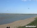
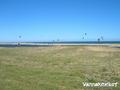
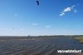
- Photos (3)
- Videos (0)
- Share
- Favourite
-
Your favourites and future spot lists
Spots
| Spots (3) | Quality | Experience | Type | Amenities | ||
|---|---|---|---|---|---|---|
| 31 De La Brava | - / - | Intermediate | Open Ocean | 


|
||
| Laguna Garzon | 2 / - | Everyone | Lagoon | |||
| Laguna Jose Ignacio | 1 / - | Everyone | Lagoon |
 Comments
Errors, Feedback
If you want to add new information or you have found errors on this country, Send us feedback.